http://tmml.sourceforge.net/doc/tcllib/mapproj.html
The 'mapproj' package in tcllib contains the conversions between geodetic (See geodesy) and map co-ordinates for a variety of map projections. A large number of projections are supported, because different applications have different needs.
Choosing a Projection
The mapproj manual gives a discussion of the choice of projections. Here is a review that attempts to illustrate some of the major points.
First: What sort of data are you displaying?
- Are directions the key point (winds, ocean currents, magnetic fields, navigational headings?) These are directional data; for directional data, you usually need a conformal projection.
- Are properties of the land or water the key point (temperature, population density, land use, demographics, etc.?) These are thematic data. For thematic data, you usually need an equal area projection.
- Is the significant aspect of your data that it shows distances from (or near to) a specific point? If so, you need an equidistant projection.
- Is the significant aspect of your data that it shows directions from (or near to) a specific point (for instance, radio antenna pointing, air routes, sight lines?) If so, you need an 'azimuthal' projection
- Do you have mixed data, or political data? You'll probably want a projection that is a compromise among the concerns above.
Second: What scale is your map?
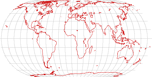
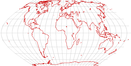
- Is it global? All projections are going to be compromises. The Mercator projection is conformal, but grossly distorts land areas. Several attractive equal-area projections are available. In addition, the Robinson projection gives attractive political world maps, and the Peirce Quincuncial projection, while curious, distorts landforms very little.
- Is it a map of a hemisphere (or a large fraction thereof?) The stereographic, azimuthal-equidistant, Hammed and Mollweide projections all can project a hemisphere onto a circle.
- Is it a large area (a few hundred km on a side?) The most attractive choice of projection depends on where on the globe it is, and whether it has a predominantly east-west or north-south extent.
- Is it a small area? In order to have map scales correct, you need to lift co-ordinates from the reference ellipsoid onto a sphere. See geodesy for a more detailed discussion.
Examples of Projections
Cylindrical Equal Area
Cylindrical equal-area projections have the advantage that they preserve land areas. Equal-area projections are, of course, preferred to present data on land use, or to present demographics. They do not have the fault of the traditional Mercator projection of exaggerating the visual importance of the high latitudes.
For any cylindrical equal-area projection, there will be one latitude (or rather, a pair of equal latitudes, North and South) where landforms are preserved. Above the standard latitude, landforms will be stretched east to west. Below it, they will be stretched north to south.
Lambert
The Lambert cylindrical equal-area projection is a cylindrical equal-area projection with a standard latitude of the Equator. It preserves equatorial landforms especially well but distorts the temperate and polar regions. It is well suited to thematic maps of countries such as Indonesia that lie near the Equator and extend primarily east and west.
Behrmann
The Behrmann projection is a cylindrical equal-area projection with a standard latitude of ±30°. It is a compromise between equatorial and temperate regions but still gives considerable distortions at high latitudes. It's a reasonable choice for thematic world maps if a rectangular display is desired.
Trystan Edwards and Hobo-Dyer
The Trystan Edwards and Hobo-Dyer projections are almost identical. (one has a standard latitude of ±37.5° while the other has ±37.5°.) They attempt to give better landforms in the temperate regions without sacrificing too much fidelity in the equatorial regions. It's a good choice for thematic world maps if a rectangular display is desired.
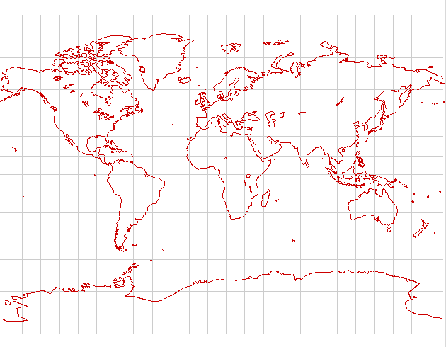
Gall-Peters

The Gall-Peters projection has a standard latitude of ±45°. It attempts to preserve temperate zone landforms, but stretches the equatorial regions considerably. Thematic maps whose emphasis is primarily the temperate regions show well on this projection.
Balthasart

The Balthasart projection, with its standard latitude of ±50°, is unabashedly Eurocentric. It preserves the landforms of Europe, Canada, Argentina and New Zealand quite well, but distorts much of the rest of the globe.
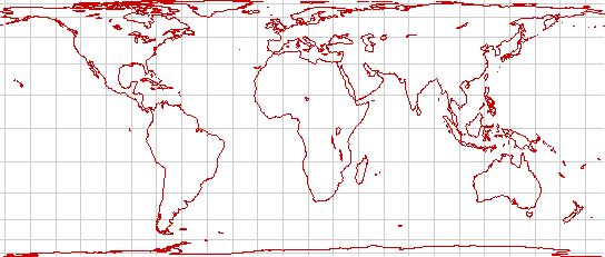
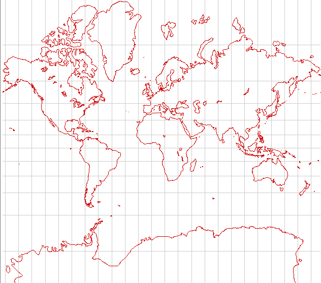
Cylindrical Equidistant
The cylindrical equidistant projection is also known as the plate carrée In it, all lines of latitude and longitude are vertical and horizontal; its North-South scale is consistent across the entire map. It is chiefly of historical interest because it is one of the easiest projections to construct. It is also still useful for large-area maps of equatorial regions that run primarily east and west. It's a poor choice for world maps because it preserves neither landforms nor areas especially well.
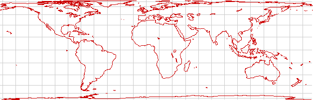
Cylindrical Conformal (Mercator)
In times gone by, the Mercator projection was seen in grade-school classroms throughout the globe. It is a conformal projection; that is, it preserves the local shape of landforms. It also has one property that was indispensible in the days of sail; a straight line on the map represents a constant compass course. (It is not a great circle, unless it is the Equator or a meridian!) Those properties make it useful for some special purposes, but its gross area distortions (showing Greenland as larger than South America, for instance) make it a poor choice as a world map.
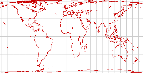
Miller Cylindrical
The Miller cylindrical projection is an attempt to preserve the appearance of the traditional Mercator map while mitigating the most extreme distortions in the polar regions. Except for the fact that it gives a traditional look to the map, it's not very useful; it's perhaps best suited to maps that will be treated as works of art.
Pseudo-Cylindrical
A number of projections derived from the cylindrical projection are useful for large-area (and world maps).
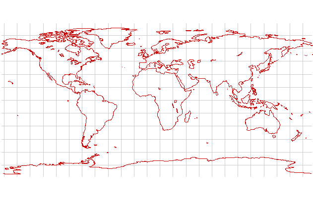
Eckert's projections
The Eckert IV and Eckert VI projections are equal-area projections that represent the Poles by straight lines half the length of the Equator. Eckert IV represents meridians by semi-ellipses, while Eckert VI represents them with sinusoids. Both are good compromise projections for use in maps of the world, giving considerable less landform distortion than any of the cylindrical projections while still preserving areas.
| Category Tcllib | Category Geography |
|---|